Mauritania: A 21-Day 4x4 Adventure
On this tour, we set out to discover the many facets of Mauritania through three completely different yet equally beautiful regions: Adrar, Tagant, and the Arguin Bank. Adrar and Tagant are the two regions that account for two-thirds of Mauritania’s palm groves. These two regions also reveal the remnants of prehistoric and historical civilizations: the Paleolithic site of El Beyed with its famous cave art; Adrar is also the birthplace of the Almoravid dynasty and home to famous caravan ports such as Chinguetti and Ouadane; Tagant also boasts historic towns like Rachid, Gasr El Barka, and others.
Banc d'Arguin National Park (PNBA) is a nature reserve in Mauritania. Covering one-third of Mauritania's coastline, it spans an area of 12,000 km², divided between the coastal zone (the Atlantic Ocean) and the inland zone (the Sahara Desert). Banc d'Arguin National Park is therefore one of the largest parks in West Africa.
Highlights : Chinguetti - Ouadane - El Beyed - Sailing trip - Banc d’Arguin - The atmosphere of the ore train - Crocodiles of Matmata - Gasr Elbarka …
YOUR TRIP
J 1 Paris - Atar
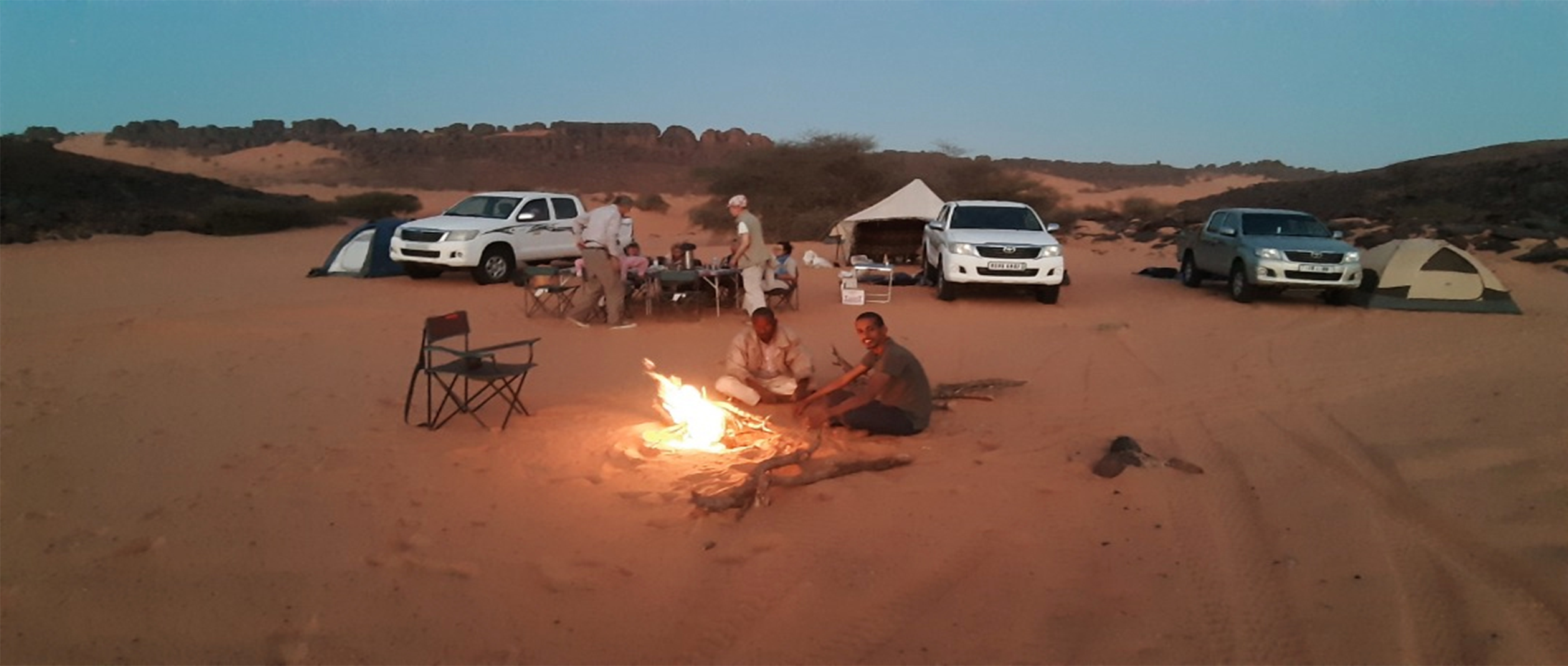
Departure from Paris (charter flight) to Atar. Meal and overnight stay at the Auberge du Bonheur.
J 2 The Chemchan Sebkha and the Aderg Inselberg
We leave Atar via the paved road at the northeast exit of the city and take dirt roads—sometimes sandy—through the foothills of the Adrar. Visit the medieval house (built around 1480) of Mauritania’s greatest religious leader. Picnic. In the afternoon, we cross—on dry land—the large Paleolithic lake of Chemcham, arriving in the late afternoon at our campsite in the Erg Makteir, facing the Aderg inselberg.
J 3 Aderg - El Beyed
Departure in the morning for El Beyed (Mauritania’s largest Paleolithic site): visit the rock art site and the Museum of Prehistory. Camp overnight.
J 4 El Beyed - Richat
We set out in the morning for Guelb Er Richat, a large crater nicknamed “the Eye of the Earth” and a true geological enigma.... absolutely breathtaking!! Camp.
"The most widely accepted explanation is that a magmatic dome formed at the intersection of fault lines about 100 million years ago and stopped growing before the dome could become a volcano. The ancient Cambrian sandstones, uplifted by the dome’s formation, were subsequently shaped by fractures and erosion to form this system of concentric cuestas that today gives Richat its somewhat mysterious character. After initially interpreting it as an astrobleme (a meteorite impact structure), geologists considered a symmetrical uplift (a circular anticline). But Th. Monod, who studied this phenomenon with a few colleagues, published, nearly half a century ago (Monod and Pomerol, 1973), hypotheses very close to the explanation commonly accepted today. Thus, since around 1980, it has been established that the Richat Structure is an “alkaline complex” resulting from a specific form of volcanism dating back 100 million years (Cretaceous: late Mesozoic era) that created a magmatic dome associated with hydrothermal activity (circulation of very hot water under extremely high pressure) This complex formed during the opening of the Atlantic Ocean.”
J 5 Guelb Er Richat – Ouadane
We leave Guelb Er Richat early in the morning and head toward the historic town of Ouadane, passing by the ruins of Agoueidir Fort (the clay remains of a Portuguese fort built around 1446). We’ll tour the old town of Ouadane. Overnight at a guesthouse.
“Ouadane, formerly known as Iwaden (a Berber name), was corrupted to Ouadane in Arabic, meaning ‘the two wadis’: the wadi of knowledge, which is the city, and the wadi of dates, which is the valley. Ouadane remains a magnificent ancient city in Mauritania, founded in the 11th century and listed as a UNESCO World Heritage Site. It remains a city steeped in history and impresses all travelers who set foot in the Adrar region. The old part of the area overlooks a hill and catches the eye with its magnificent ruins.”
J 6 Ouadane – Tenochert - Mezrougatt
We leave Ouadane via the sand dunes, heading due west. We stop for a picnic in the beautiful little palm grove at Tenochert before passing through a narrow pass to exit Herour (an esker formed by a powerful glacial river). We then head toward the small semi-nomadic camp of Rghewiya. We set up camp amid the dunes of Efam El Mezrougatt.
J 7 Mezrougatt - Chinguetti - Zarga
Departure in the morning for the city of Chinguetti, traveling through the beautiful dunes of Mezrougatt. Visit one of the oldest libraries (ancient manuscripts) and the ruins of the ancient city of Chinguetti, considered the seventh holy city of Islam.
“Chinguetti has about ten libraries, four of which are open to the public. Some items in these collections date back to the 11th century, including some written on gazelle skins. Most of these works deal with religion and the Quran, but many cover science, geometry, or literature.
The city has been listed as a UNESCO World Heritage Site since 1996. »
We set out in the early afternoon, following the sandy wadi toward Mount Zarga. We camped opposite the beautiful Tichilit El Ateg dune, which is the highest point of the Zarga massif and the third-highest peak in the Adrar range.
J 8 Zarga - M’Heireth - Timinit
We set out early from Zarga on a trail that starts out sandy but becomes scenic toward the end. We reach the beautiful palm grove of M’Heireth, which we cross to arrive at Terjit via the scenic N’tourvine Pass. We have a picnic under the caves near the warm spring at Terjit.
In the early afternoon, we leave Terjit and return to the paved road heading toward the beautiful palm grove of Timinit. Camp around the beautiful dune of Mint Leboudi.
J 9 Timinit - Tawjavet - Rachid
From Timinit, we head toward Tagant along the paved road connecting Atar to Tidjigja, which takes us into the northern part of Tagant. We cross the El Khatt depression, which separates the Adrar region from the Tagant region. We camp near the beautiful Tawjavet guelta.
J 10 Rachid - Tidjigja - Quediya
After visiting the ruins of the old town of Rachid, we drive through the town of Tidjigja, the capital of the Tagant province. We then continue on toward Quediya and its beautiful guelta, passing through Megsem Boubakar ben Amer. We set up camp in Quediya.
J 11 Quediya - N’beika - Matmata
We ride due west along a rough, 60-km-long dirt track to rejoin the paved road at Igevan, 70 km from N’beika, the capital of the rural commune of Tamourt Naaj. The area’s flora and fauna are incredibly diverse and abundant: birds, rodents, monkeys, and more. We have a picnic by a pond west of the village.
In the early afternoon, we head up the Tamourt Naaj valley toward Matmata, famous for its Nile crocodiles that have been trapped in this stunning rocky site for several centuries!! Campsite.
J 12 Matmata - Nbeika - Guebbou - Gasr El Barka
We set off early in the morning for N’beika. We head toward Guebbou. We stop for a picnic in the Tamourt Naaj Valley before arriving in Gasr El Barka, a historic town built in the 17th century. We set up camp.
J 13 Gasr El Barka - Ain Safra
Early morning departure from Gasr El Barka, off-road, heading due west, to rejoin the trail leading to the villages of Jemjiya and Nwar. After a picnic in Nwar, we return to the paved Tijigja-Atar road, 80 km from Ain Safra. Camp.
J 14 Ain Safra - Abteily - Hnouk
Heading due west, we leave the paved road at El Maleh and make our way to the beautiful Hnouk Gorge (the “jaws”) via the picturesque N’teirguent Valley. We set up camp at Hnouk.
J 15 Hnouk - Toungad - Akjoujt (environs)
From the beautiful Hnouk Gorge, we head out along the wadi toward the charming village of Wakchoda, with its lovely dry-stone buildings. We then follow the Timint Wadi down into the White Valley. Visit the palm grove and the Toungad guelta before taking the paved road from Atar to Akjoujt. Camp on the beautiful dunes of Maal Ichigdan.
J 16 Akjoujt - M’heijratt
We return to the paved road from Atar to Akjoujt to Nouakchott, which we leave at the mining town of Akjoujt (copper and gold mines) as we pass through it on our way to Benichab (a village famous for its mineral waters). We continue due west toward the Atlantic Ocean. We camp near M’heijratt.
J 17 M’heijratt - Iwik
From M’heijratt, we continue due north toward Iwik, rejoining the paved Nouakchott–Nouadhibou highway, which we’ll leave at the “Bouaamatou station,” about 250 km from Nouakchott. We head due west toward the Iwik Peninsula. Overnight at the inn.
J 18 Balade Maritime
Our Imraguen fisherman friends will take us on a beautiful boat trip through the coastal section of Banc d'Arguin National Park, aboard a locally built sailboat, surrounded by thousands of resident and migratory birds.
This trip is a journey of discovery through the park, one of the largest in West Africa.
After the boat trip, a short drive will take us back to the beautiful site of Arkeiss. We’ll spend the night in tents on the beach.
J 19 Arkeiss - Chami - Nouadhibou
We leave the village of Arkeiss early in the morning and head toward Chami, where we rejoin the paved Nouakchott–Nouadhibou highway.
Nouadhibou is a mineral ore port but also a very active fishing port. Visit to Cap Blanc with its monk seal colony (a colony of 150 monk seals, which makes up half of the global population estimated at 300). Overnight camping near Boulenwar.
J 20 Nouadhibou - Ben Amira
From Boulenwar, we head toward Ben Amira, driving due east along the dirt road that runs parallel to the railroad connecting Nouadhibou (the port) to Zouerate (the mining town).
After a lunch break, we continue our journey alongside the railroad tracks until we reach the vicinity of the Ben Amira Monolith. The atmosphere is that of a ore train. Campout.
J 21 Ben Amira - Atar
After visiting Aicha’s site (engravings and modern art objects commemorating the turn of the millennium), we head for Atar. We spend the night at the Auberge du Bonheur.
J 22 Atar - Paris
Transfer to the airport, flight to Paris.
This trip can be completed in 22 days starting from Nouakchott.